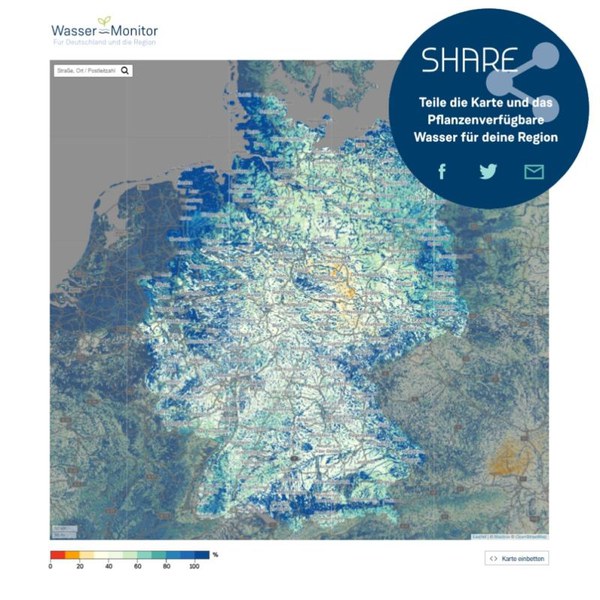
Explore the Wasser-Monitor
How dry is the soil today and how will soil moisture develop in the coming days?
The Wasser-Monitor provides an overview of the water balance in the soil at a very high spatial resolution of around 600 meters for the whole of Germany and neighboring areas. You can zoom into the interactive map on the Wasser-Monitor homepage, even down to the desired street if you enter an address. This allows you to see for a period of up to nine days into the future whether your own soil has enough water for plants or whether you, as a farmer or hobby gardener, would be better off reaching for a watering can.
The development of the Wasser-Monitor is the result of a unique knowledge transfer project, which was realized in equal parts by the scientific institute IBG-3 and Jülich Corporate Communications. The IBG-3 scientists Klaus Görgen and Alexandre Belleflamme, together with the communications expert Marcel Bülow, have created an application that is freely available online for everyone in the wider context of the DG-RR innovation laboratory (BioökonomieREVIER) and the APADTER project. As the application not only depicts the current state of the water balance, but also provides daily forecasts, the background calculations for the Wasser-Monitor are so complex that they have to be performed on the fastest mainframe computers in Europe at the Jülich Supercomputing Center (JSC). However, the user interface of the online application is user-friendly and the explanations on how to evaluate your own data are presented in a way that everyone can understand. This makes it easy for anyone to find scientifically founded answers to the pressing questions of our time. Because water in the soil - in times of climate crisis with its devastating flood and drought disasters, this is increasingly the question of - too much or too little?
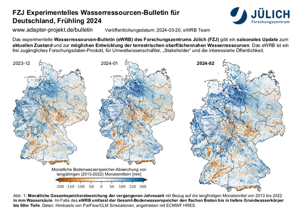
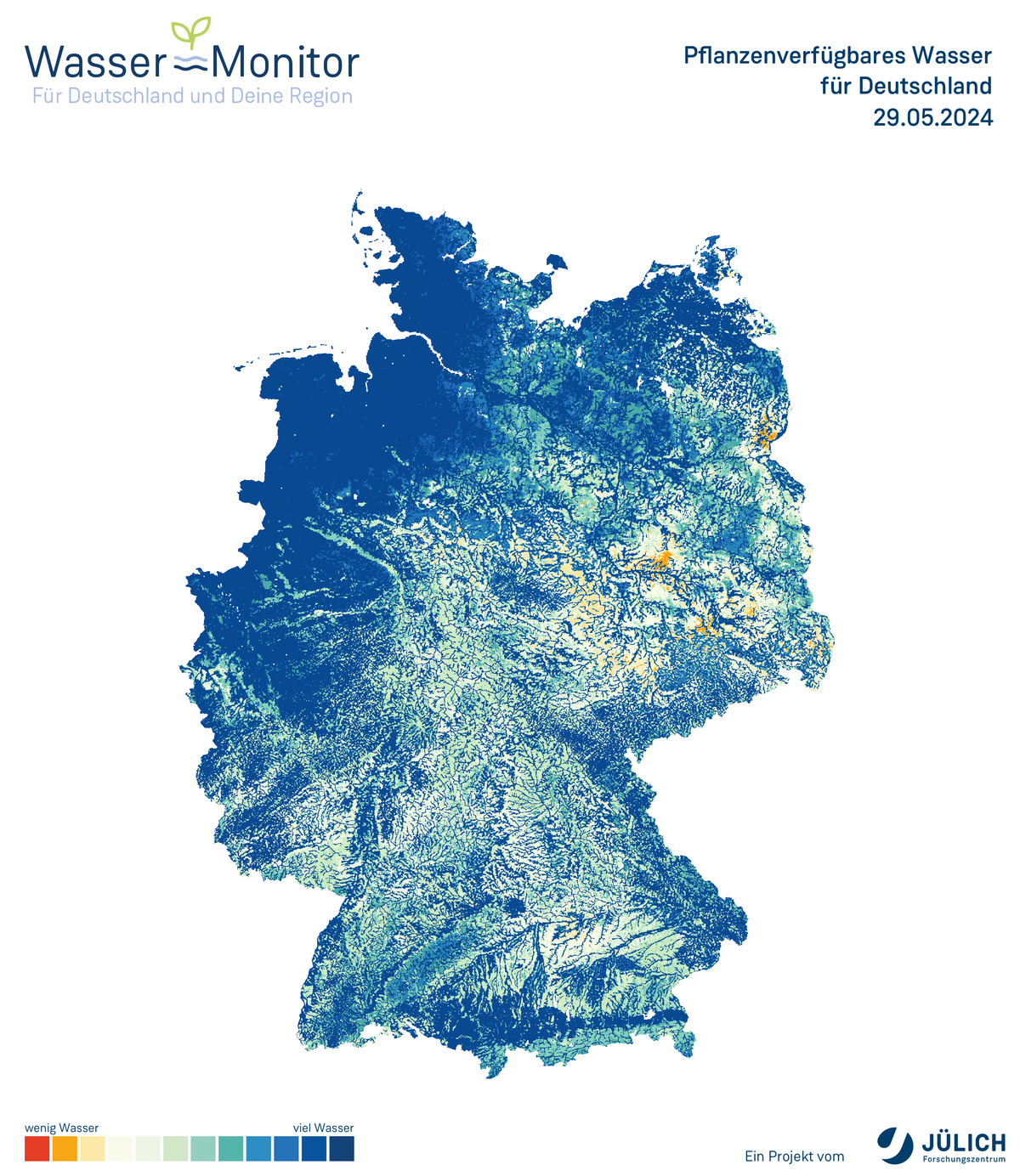
Due to the high societal relevance of this issue, the scientific supervision of the transfer project continues in parallel: in the seasonal Water Resources Bulletin (eWRB), the supervising scientists provide a seasonal update on the current status and possible development of terrestrial near-surface water resources in addition to the online application. The eWRB is a freely accessible research data product for environmental scientists, stakeholders and the interested public. The maps and diagrams presented here are explained by texts for each season (spring, summer, fall and winter of each year) and are available for download and further use.

- Institute of Bio- and Geosciences (IBG)
- Agrosphere (IBG-3)
Building 16.6 /
Room 2032
Room 2032
+49 2461/61-1889
E-Mail

Dr. Klaus Görgen
Senior Scientist in Integrated Modelling of Terrestrial Systems Group (Prof. S. Kollet)
- Institute of Bio- and Geosciences (IBG)
- Agrosphere (IBG-3)
Building 16.6 /
Room 3035
Room 3035
+49 2461/61-6456
E-Mail
Dr. Marie-Isabel Ludwig
Wissenstransfer und Kommunikation
- Institute of Bio- and Geosciences (IBG)
- Agrosphere (IBG-3)
Building 16.6 /
Room 3037
Room 3037
+49 2461/61-9012
E-Mail
Last Modified: 01.07.2024